
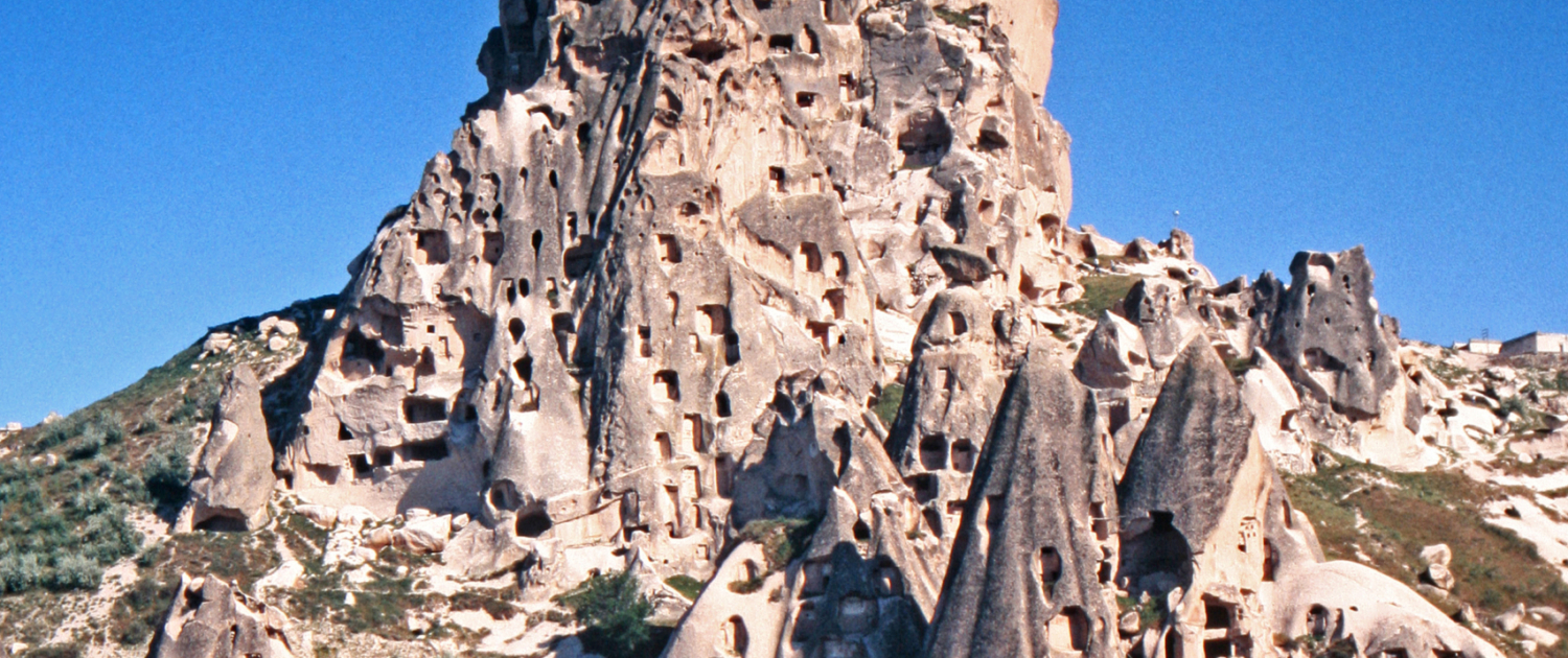
Beneath the volcanic plateau of central Anatolia lies a network of subterranean cities, rock-cut churches, and hydraulic tunnels that took three millennia to build. The evidence has been exhaustively documented, but most of it has never been translated into English.
1. An Accidental Discovery
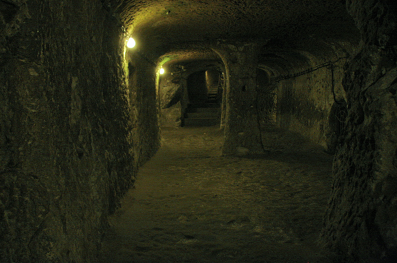
Derinkuyu underground city
In 1963, a homeowner in Derinkuyu broke through a wall during renovation and found a room that led to another room, then another, then a staircase descending into darkness. The resulting excavation uncovered an eighteen-floor underground city reaching eighty-five metres below the surface, with ventilation shafts, stone doors, churches, stables, and storage halls. Derinkuyu was not unique. It was one node in a network that riddles the Cappadocia region.
The discovery forced a rewrite of what archaeologists thought they knew about underground construction in the ancient world. Before 1963, the largest known subterranean complexes were the Roman catacombs and the Basilica Cistern in Istanbul. Derinkuyu alone could hold twenty thousand people. Kaymaklı, nine kilometres away, was larger still. The two were probably connected by a tunnel whose ventilation shafts have since been filled with rubble.
A homeowner broke through a wall and found eighteen floors of city beneath his house.
2. The Volcanic Machine
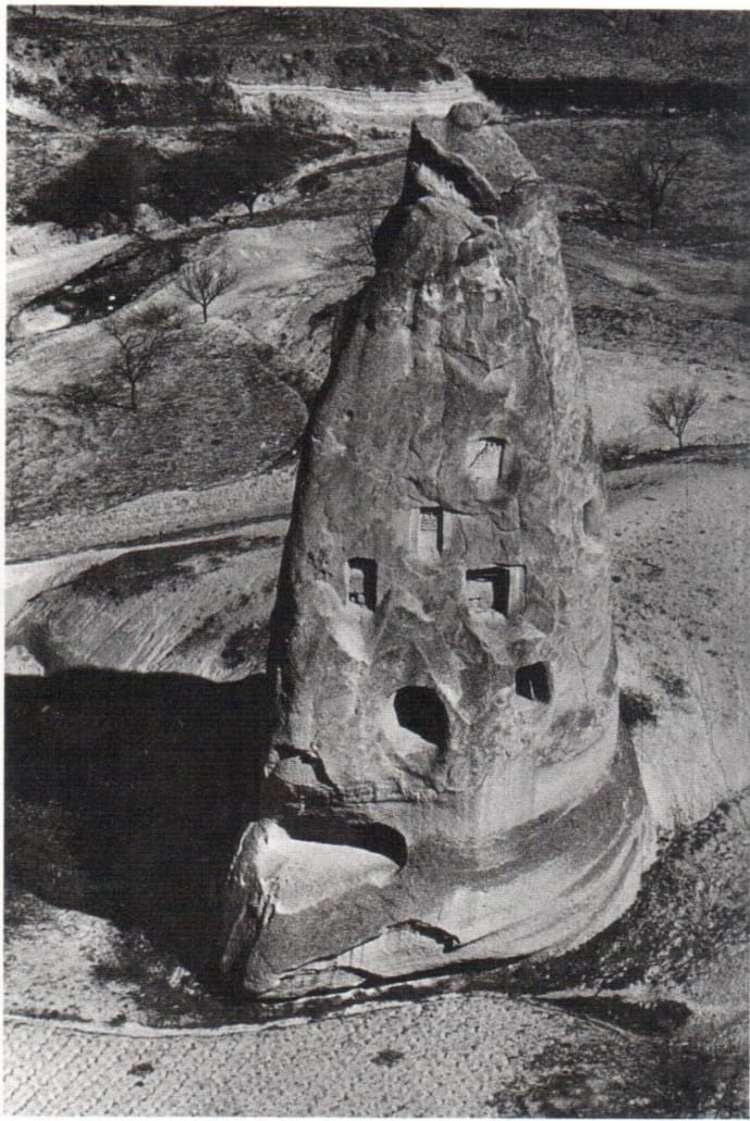
Goreme Valley, Turkey
The underground cities exist because of a specific geological accident. Eight million years ago, the volcanoes Erciyes (3,917 m), Hasandağ (3,254 m), and Melendiz (2,935 m) erupted repeatedly, covering central Anatolia in horizontal layers of ash, lava, and cinder hundreds of metres thick. The ash consolidated into a soft white rock called tuff. The lava cooled into hard black basalt.
Over millions of years, rain and wind cut narrow gorges through the soft tuff. The basalt caps fractured and broke apart. Where a
basalt boulder sat on top of a tuff pillar, it shielded the column below from erosion. The result was the fairy chimneys: isolated rock spires up to thirty metres tall, each capped by a black basalt hat. The entire Cappadocia region covers roughly five thousand square kilometres of this volcanic plateau, sitting between one thousand and one thousand four hundred metres above sea level.
The tuff is what made the underground cities possible. Aydan and Ulusay measured its uniaxial compressive strength at between one and ten megapascals. That is weak enough to carve with hand tools. Erguvanlı and Yüzer estimated that a single worker could remove seventy to one hundred cubic metres of tuff per month using only basic implements. The rock is also porous, with effective porosity between fourteen and forty-two percent, which gives it strong thermal insulation. The same property that makes it easy to dig makes it cool in summer and warm in winter.
| Property | Ürgüp (Kavak Tuff) | Avanos (Zelve Tuff) | Derinkuyu (Gördeles Tuff) |
|---|---|---|---|
| Dry unit weight (kN/m³) | 11.2–17.3 | 10.9–15.1 | 13.8–14.3 |
| Effective porosity (%) | 28.0–37.6 | 28.8–41.6 | 14.1–28.5 |
| UCS, dry vertical (MPa) | 2.5–10.4 | 1.0–7.0 | 2.5–8.0 |
| Tensile strength (MPa) | 0.30–0.46 | 0.26–0.46 | — |
– Aydan & Ulusay, Engineering Geology (2003), Table 2
3. Scale
Twenty-two large-scale underground cities are confirmed in the Cappadocia region. The Italian Centro Studi Sotterranei, working in the 1990s, documented one hundred and eighty-three individual underground sites across six administrative districts: Aksaray (59 sites), Nevşehir (71), Kayseri (24), Niğde (22), Yozgat (4), and Kırşehir (3). Another twenty-four sites were reported but not located. The total exceeds two hundred known subterranean structures in a single region.
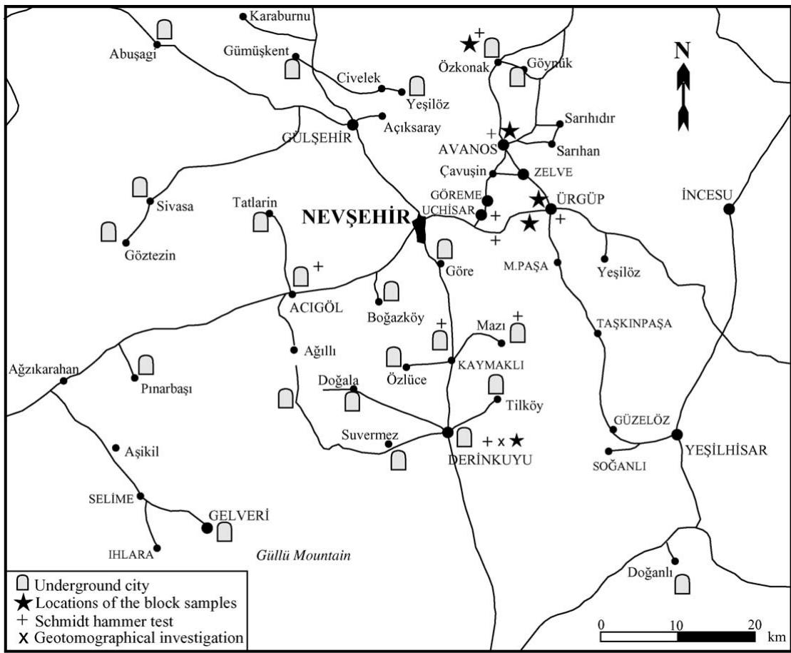
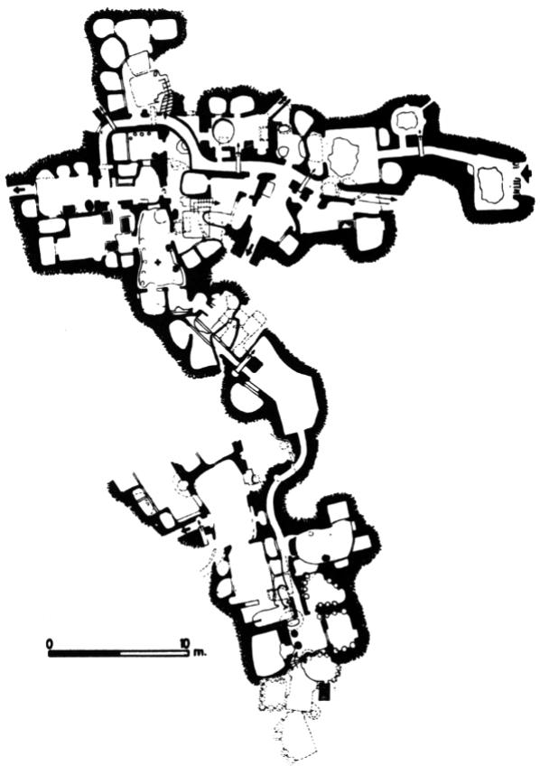
Derinkuyu covers four square kilometres and reaches eighty-five metres deep. Kaymaklı is said to have accommodated sixty thousand people. Özkonak, fourteen kilometres north of Avanos, has only fourteen spaces connected by long narrow communication holes. Tatlarin, on the Nevşehir–Aksaray road, has three entrances and a church, monastery, kitchen, dining room, wine cellar, and stable. Saratlı, further west, stretches one point five kilometres across two floors. The variation in scale and plan suggests different functions: some were refuges, others permanent settlements, others monastic complexes.
4. Engineering
The underground cities share a set of design features that solved the problems of ventilation, defence, water, and waste in a sealed environment.
Ventilation. Derinkuyu has fifty-two ventilation chimneys ranging from seventy to eighty-five metres in length. Aydan and Ulusay noted that shafts dug downward served as water wells while shafts dug upward provided fresh air to every floor. The system used self-propelled air circulation: temperature differences between the cooler lower floors and the warmer surface created a natural draft. More than fifty shafts have been mapped in Derinkuyu alone. The Czech team led by Nývlt counted the same number and concluded that the entire system was designed so that even the lowest and most remote chambers received sufficient airflow.
Stone doors. Between each floor, circular millstone doors one to one point five metres in diameter and thirty to thirty-five centimetres thick could be rolled into place from the inside. The central hole allowed defenders to spear intruders who tried to force the door. These doors could not be opened from outside. The corridors connecting floors were made long, low, and narrow to restrict the movement of attackers.
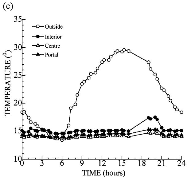
Climate control. Erguvanlı and Yüzer took temperature readings in June 1977. Outside, the air was twenty-seven degrees Celsius. On the first and second floors of Kaymaklı, it was twelve degrees. On the third and fourth floors, ten degrees. At Derinkuyu, the first floor registered twelve degrees, the sixth floor nine degrees, and the eighth floor seven degrees. The underground climate is stable year-round: cool in summer, warm in winter, with minimal variation between floors.
| Location | Floor | Underground Temp | Outside Temp |
|---|---|---|---|
| Kaymaklı | 1st–2nd | 12°C | 27°C |
| Kaymaklı | 3rd–4th | 10°C | 27°C |
| Derinkuyu | 1st | 12°C | 27°C |
| Derinkuyu | 6th | 9°C | 27°C |
| Derinkuyu | 8th | 7°C | 27°C |
Erguvanlı & Yüzer, June 1977 measurements
5. The Historical Layers
Who built the underground cities? The honest answer is that nobody knows for certain. The written sources are thin. The Italian monograph History Inside the Rocks of Cappadocia devotes an entire chapter to the problem of missing ancient texts. No surviving document describes the construction, organisation, or daily life of these complexes in detail. What exists is fragmentary: a line in Strabo, a letter from Basil of Caesarea, a passing reference in a saint’s vita.
The archaeological evidence points to multiple phases of use. The Hittite Empire controlled this region in the second millennium BC. Hittite texts refer to a “Lower Land” that probably corresponds to the Cappadocian plateau. Rock-cut inscriptions in Hittite hieroglyphs have been found at three sites near underground structures, though no direct link has been established. After the Hittite collapse in the twelfth century BC, the region fragmented into Neo-Hittite kingdoms. Tabal, one of these kingdoms, occupied roughly the same territory.
The Phrygians and Assyrians contested central Anatolia in the eighth and seventh centuries BC. Martin Urban, a German geologist who studied the region in the 1970s, proposed that the earliest underground shelters date to this period. He argued they functioned as military outposts during the Phrygian-Assyrian conflict, not merely as refuges but as barracks for troops ready to intervene. The Christians reused them centuries later.
Byzantine monasticism transformed the region between the seventh and thirteenth centuries. Basil of Caesarea (329–379) established the Cappadocian monastic tradition by promoting small hermit communities rather than large isolated monasteries. Gregory of Nazianzus, writing to Basil in 361 AD, described his chosen hermitage as a place “where precipices and overhanging rocks force travellers to acrobatic efforts for their own safety.” The Göreme valley became a centre for monastic education between 725 and 845 AD. Chapels, basilicas, cruciform churches with one or several domes, and dwellings up to six stories high were carved into the tuff.
The iconoclastic period (726–845 AD) interrupted church decoration. Figurative painting returned around 850 AD. The most magnificent rock-hewn churches date from the tenth and eleventh centuries, when wealthy noblemen competed to commission the best frescoes. After the Turkish invasions of the thirteenth century, church construction and decoration ceased.
6. Rock-Cut Churches
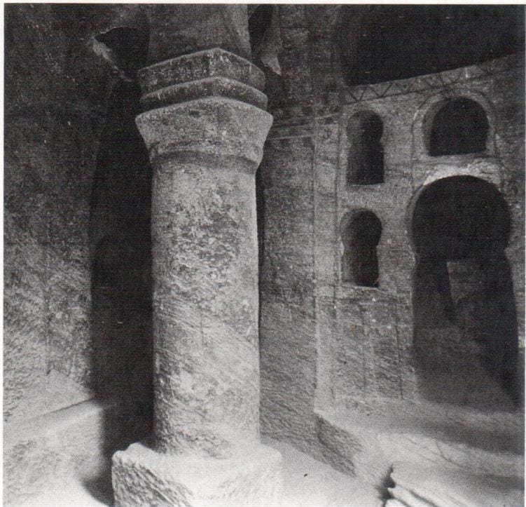
The churches are not separate from the underground cities. They are part of the same architectural logic: carve what you need from the rock rather than building it from blocks. The Göreme Open Air Museum alone contains dozens of churches, chapels, and monasteries. Tokalı Kilise (the Buckle Church) is the largest, with frescoes depicting scenes from the lives of Jesus and the Apostles. Karanlık Kilise (the Dark Church) contains Nativity scenes. Elmalı Kilise (the Apple Church), Yilanlı Kilise (the Snake Church), Çarıklı Kilise (the Sandals Church), and the Church of St Barbara each have distinct iconographic programmes.
Beyond Göreme, the Ihlara Valley holds over one hundred rock-cut churches and four thousand five hundred caves carved into the walls of a fourteen-kilometre-long, one-hundred-and-seventy-metre-deep canyon. The valley runs west from Aksaray toward Nevşehir. The churches date from the seventh to the thirteenth centuries. The density of occupation is comparable to Göreme but the setting is different: a narrow gorge rather than an open valley, with churches clustered along both walls.
The Ürgüp cones alone contain more than one hundred and fifty rock-hewn churches. Most are small barrel-vaulted chambers with a rectangular nave and a simple apse, rarely exceeding eight metres in length. The monks decorated them with crosses, fish, pomegranates, and palm trees. After iconoclasm ended, biblical narratives returned in long segmented paintings. The finest frescoes date from the tenth and eleventh centuries.
7. Water Systems
The underground settlements required water. The sources are explicit on this point but sparse on detail. Jerphanion, visiting in 1907, recorded a long tunnel that carried water to Ürgüp. George Cousin, who followed the same tunnel in 1898, reported that “the water travels underground for three hours before arriving at Urgub.” Local inhabitants told Cousin the tunnel was built by Ibrahim Pasha, the Egyptian conqueror whose troops entered Cappadocia in 1832. If that attribution is correct, the aqueduct postdates 1832.
But the underground water infrastructure is older than the Ottoman period. The Italian mission found cistern-cuniculi (tunnel-cisterns) in the Göreme area that used snowmelt collected in artificial basins called sughla. These basins, attested in Ottoman sources, channeled meltwater into underground cisterns that maintained cool temperatures year-round. The system is probably Byzantine in origin, possibly earlier. Blanchard (1981) mentions a system of cisterns and underground channels. White (1904) noted “snow-pits” at Ürgüp without describing the full hydraulic network.
Wells inside the underground cities served dual purposes. Shafts dug downward reached the water table. Shafts dug upward provided ventilation. The same hole could function as both well and air shaft depending on its orientation. Derinkuyu had fifty-two such shafts. Until 1962, the townspeople drew water from these wells using pulley wheels.
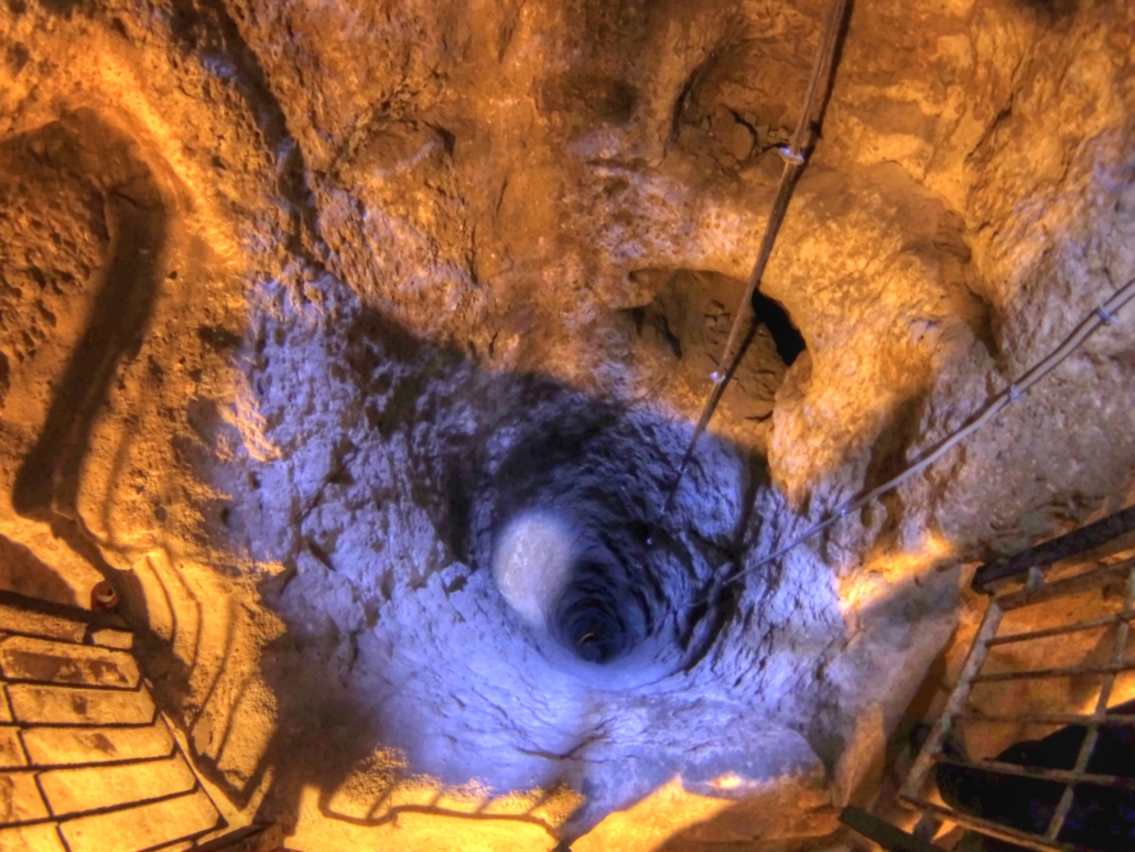
A deep ventilation well in the city of Derinkuyu
8. The Italian Monographs
The most comprehensive scholarly treatment of Cappadocian underground spaces exists only in Italian. Two monographs, both produced by the Centro Studi Sotterranei in Genoa and the University of Tuscia in Viterbo, document the results of speleological surveys conducted from the 1990s onward.
Cappadocia: Records of the Underground Sites catalogued one hundred and eighty-three sites and proposed a typological classification distinguishing anthropogenic cavities from natural caves, with intermediate forms such as courtyard settlements and modified natural caves. The authors paid particular attention to defensive organisation, classifying some settlements as rifugi bellici (military shelters) based on their strategic positioning and fortification features.
History Inside the Rocks of Cappadocia, directed by Maria Andaloro, focused on Göreme and Şahinefendi. The team used modern speleological techniques to access and document underground structures that had never been surveyed. The introduction frames the work as continuing the legacy of Guillaume de Jerphanion, the Jesuit priest who between 1907 and 1927 published the first monumental documentation of Cappadocian rock churches. Jerphanion’s work, in four volumes with nearly six hundred photographs on glass plates, remains foundational. The Italian mission found new sites across a wider territory than Jerphanion had covered and identified structures he had missed.
The ancient sources chapter in History Inside the Rocks is the most thorough treatment of the textual evidence available. It maps the Hittite Empire’s borders onto the Cappadocian plateau, identifies the “Lower Land” of Hittite texts with the later Neo-Hittite kingdom of Tabal, and traces the Phrygian-Assyrian conflict as a possible context for the earliest underground shelters. It also collects every passing reference from Strabo, Basil, Gregory of Nazianzus, and the church fathers that might relate to rock-cut habitation.
Kaymakli
9. The Present
The underground cities are still in use. Aydan and Ulusay noted that modern excavations in tuff serve housing, food storage, mushroom plantations, pigeon holes for fertiliser, and ceramic factories. Underground citrus storage houses near Ürgüp operate at seven to twelve degrees Celsius year-round, controlled by ventilation. Three million tons of apples, lemons, and oranges are stored annually in the Göreme region using these facilities.
The same thermal properties that attracted Hittite-era diggers make the tuff useful today. The rock is easy to carve, self-supporting, and naturally climate-controlled. The underground cities were not abandoned because they stopped working. They were abandoned because the threat model changed. When Arab raids ended in the tenth century, the defensive advantage of living underground diminished. When modern refrigeration arrived, the thermal advantage diminished further. But the structures themselves remain intact. The tuff has held up for at least fifteen hundred years.
10. What Remains Unknown
The dating problem is unresolved. No archaeological excavation has established a firm chronology for the initial excavation of Derinkuyu, Kaymaklı, or any other underground city. The Hittite hypothesis rests on proximity and textual inference, not on stratified finds. The Phrygian-Assyrian hypothesis rests on Urban’s military interpretation of site distribution. The Christian reuse is well attested by frescoes and church architecture, but the churches occupy upper floors. The lower levels remain undated.
The tunnel between Derinkuyu and Kaymaklı is assumed but not confirmed. The air shafts have been filled with stones and soil. No excavation has traced the full route. The same applies to the reported connections between other underground cities. The Italian survey found one hundred and eighty-three sites but noted that many more are probably waiting to be discovered beneath cultivated fields and modern houses.
The water systems are poorly understood. The Ürgüp aqueduct is attested by Cousin and Jerphanion but has not been fully surveyed. The Göreme cistern-cuniculi are documented in the Italian monograph but not published in English. The snow-pits, the sughla basins, the underground channels: all of this infrastructure is visible on the ground but invisible in the Anglophone literature.
The ECDO corpus quite possibly contains a comprehensive collection of sources on Cappadocian subterranean architecture. Most of it has never been translated. The Italian monographs alone exceed one point five million characters. The Turkish sources, including Demir’s guidebook and Çelik’s archaeological survey, add another four hundred thousand. The English-language academic literature, represented by Aydan and Ulusay and by Erguvanlı and Yüzer, provides the quantitative backbone: geotechnical properties, temperature data, carving rates, structural assessments. Together, these sources describe a subterranean landscape that rivals the surface in scale and complexity.
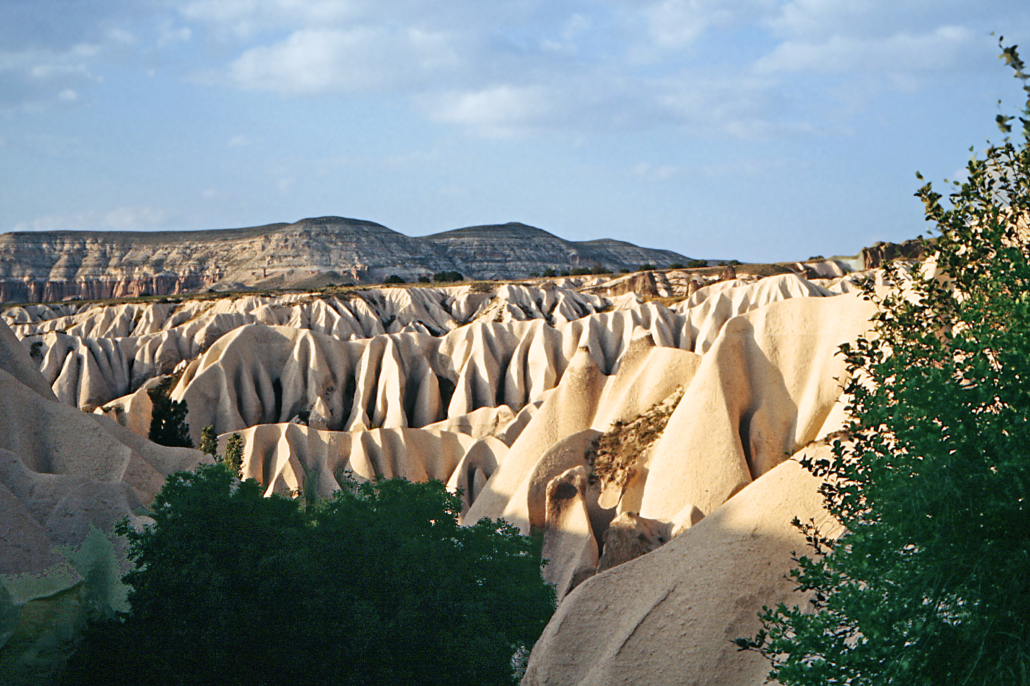
Goreme National Park
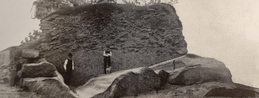
The drift is a remarkable stratum of clay, sand, gravel, and far-from-source boulders seemingly flung by some careless hand over the northern portions of Europe and North America. Some of this debris has been moulded into distinctive ridges (moraines), rounded hills (drumlins), and long sinuous ridges (eskers). Any theory of drift formation must account for these singular accumulations as well as an immense family of scratches, lake basins, and sundry gougings.
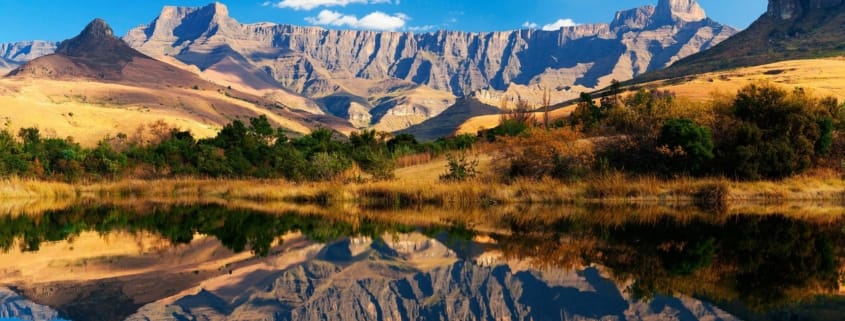
“Just as in the case of all other countries, the earliest pages in the Geological Record of South Africa are most fragmentary and utterly confusing; much remains to be done before even the outlines can be reconstructed. It must suffice to remark that at some extremely remote date, possibly more than 1000 million years ago, basic lavas—seemingly the earliest known of the rocks—were being poured out over several large sections of this country, in many places sub-aqueously—probably upon the ocean floor—that they were accompanied and followed by tuffs, slates, limestones, and the remarkable group of the banded ironstones, jaspilites, and cherts, and by quartzites, grits, and conglomerates.”
The first obstruction to knowledge is often not the world itself, but the human instrument by which the world is received.
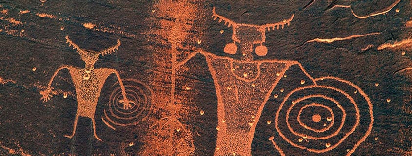
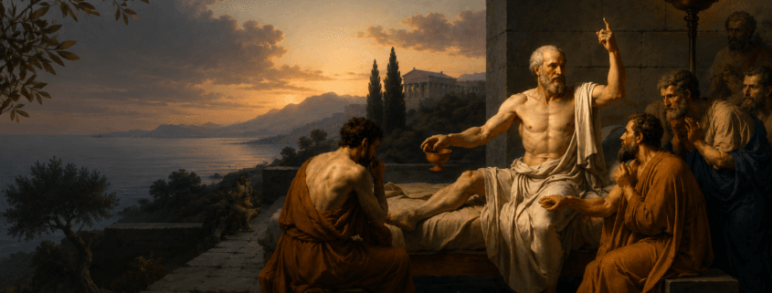
A people who saw the sea arrive where no sea belonged would not leave behind a peer-reviewed monograph. They would leave a story. And the descendants of that story would eventually be mocked by men who mistake their own notation for reality.
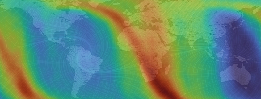
If the Earth has rapidly reoriented in the past, the resulting inertial mismatch between the solid Earth and its fluid envelopes would drive high-velocity surface transport. The atmosphere, hydrosphere, and unconsolidated materials would be mobilised along coherent trajectories dictated by the rotation geometry, producing large-scale, directionally organised flow fields. These flows would imprint persistent anisotropic signatures into the geological and geomorphological record, expressed through aligned erosional features, sediment transport pathways, and coherent structural overprints.
